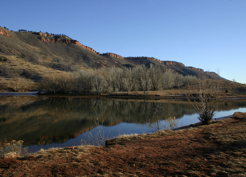
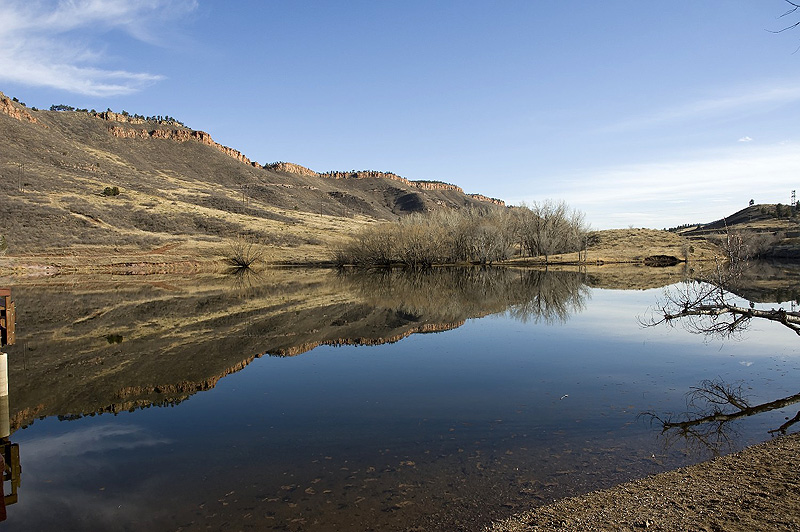
Flatiron Reservoir
Northwest of Carter Lake
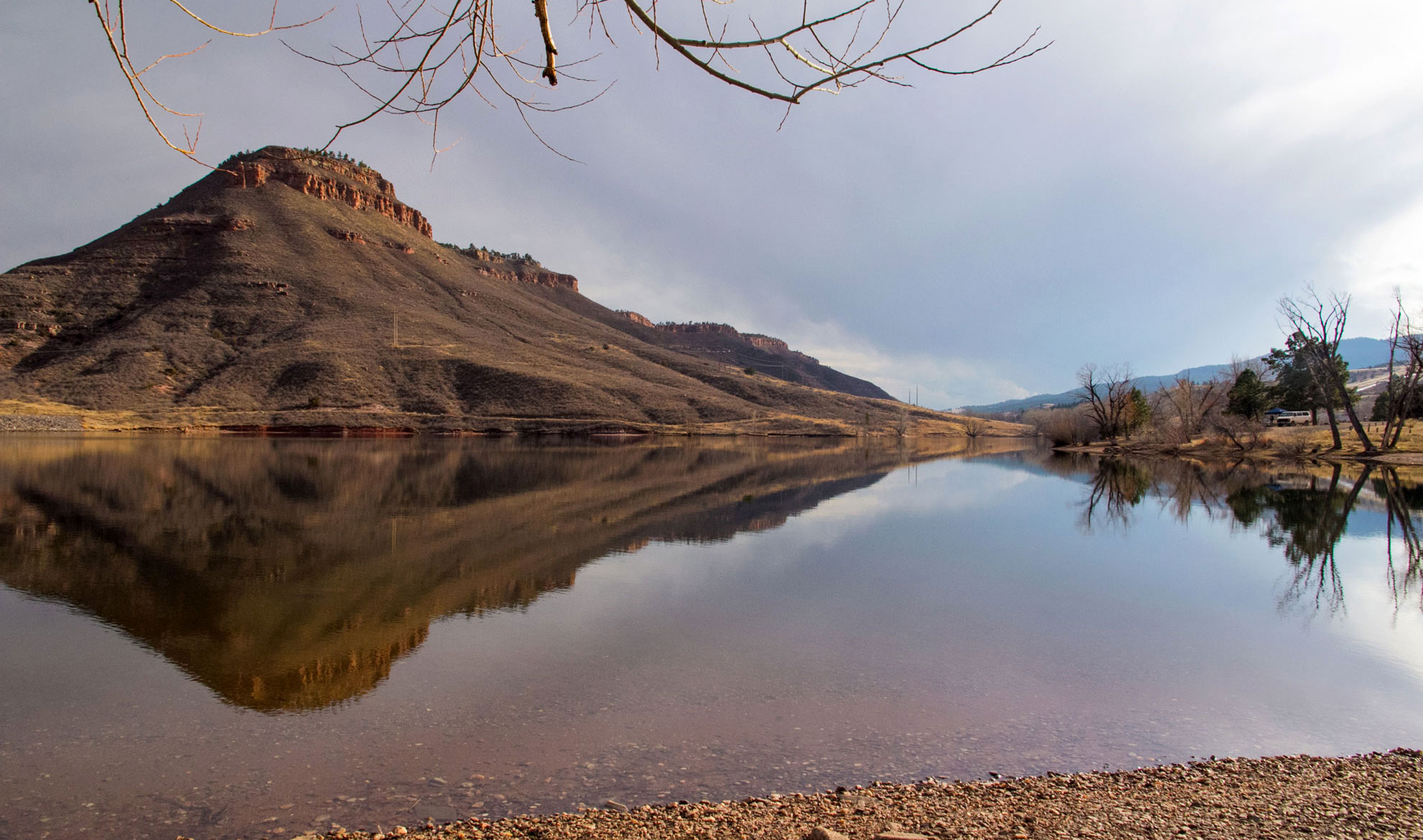
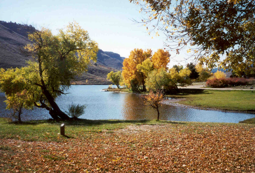
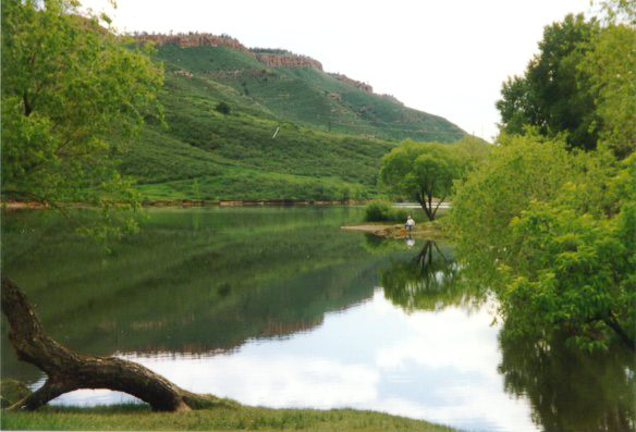
This quiet, 47-acre reservoir is surrounded by 200 acres of public lands and is a popular spot for fishing, picnicking, and family camping. At 5,470 feet in elevation, it sits a few miles northwest of Carter Lake, southwest of Loveland, and northwest of Berthoud.
Flatiron is part of the Colorado-Big Thompson Project, which diverts water from the west slope to the east slope for drinking water, irrigation, and hydropower generation. The Bureau of Reclamation and Northern Colorado Water Conservancy District jointly operate the reservoir and manage water levels for irrigation, municipal, and industrial use. Larimer County manages recreation.
The reservoir is open year-round and requires entrance and camping permits.
Why swimming and boating aren't allowed
Flatiron serves as the afterbay for upstream power plants, meaning water levels rise and fall throughout the day based on power generation and water demand. These potentially sudden fluctuations make swimming, boating, and paddleboarding unsafe.
If you're visiting:
- Pay attention to posted high water signs
- Stay off the spillway
- For swimming and boating, head to nearby Carter Lake
Brochure Brochure (Spanish) Trail Map Entrance Permits Reserve a Campsite Regulations
Features
Map & Directions
From Denver:
- Take I-25 North to the Berthoud Exit (Exit 250).
- Turn left (west) onto Highway 56 and continue for 9 1/2 miles. (You will pass through the town of Berthoud.)
- Watch for the Carter Lake road sign after a sharp curve to the north (right).
- Turn left (west) onto County Road 8E and continue for 3 miles.
- Stop at the entrance station to purchase Park Entrance Permits, Follow County Road 8E west to the intersection about halfway up the hill. A sign will direct you to continue straight to the South Shore Campground or to turn right to Carter Knolls Campground, the swim beach, Big Thompson Campground, Carter Lake Marina, Eagle Campground, Lowell's Campground and North Pines Campground. The Natural Resources Department is located about 2 miles north of Carter Lake at 1800 South County Road 31.
From Longmont or Boulder:
- Take U.S. Highway 287 north to County Road 56 west of Berthoud.
- Turn left (west) onto County Road 56.
Follow direction from # 3 above
From Loveland:
- Drive west of Loveland on U.S. Highway 34 to mile marker #85. Watch for the "Carter Lake" sign.
- Turn left (south) onto County Road 29. Go 2 miles and turn right (west) onto County Road 18E. Go west another 2 miles. Watch for the park signs.
- At County Road 31 turn left and stop to purchase park entrance permits at the entrance station on your right or at The Natural Resources Department. Continue south on County Road 31 another 2 miles to Carter Lake, campgrounds, marina, and swim beach.
From Fort Collins:
- Take Taft Hill Road south from Fort Collins to U.S. Highway 34 (Eisenhower) in Loveland and turn right (west).
Follow directions from Loveland above.
Trails & Weather
Trails
List of All LC Trails
 Facebook
Twitter
Facebook
Twitter
Weather
Alerts from the National Weather Service:
Effective: | Onset: | Expires: | Ends:
Larimer County Emergency Department Alerts: View Sign Up for Email & Text Notifications
Weather
Weather
-Hour Forecast
° HI:
%
%
Precip: Precipitation Probability
Humid: Relative Humidity
Wind: Wind miles per hour & direction
Conditions
Water Temp: °F
BE BEAR AWARE: Avoid attracting bears to your campsite
- Never leave food, cooler or trash unattended. Any food, coolers or trash left out may be confiscated.
- Properly store your trash, food, beverages and toiletries in a locked hard-sided container constructed of rigid material. Keep anything with a scent in your vehicle or a bear-proof container. Put trash in dumpsters located at each campground.
- Keep a clean tent. Don't bring anything with an odor into your tent. Don't sleep in the clothes you cooked in; store them in your vehicle.
- Never intentionally feed a bear.
HELP KEEP COLORADO'S WILDLIFE WILD!
Self-serve permit stations are NOT available at this reservoir. Permits can be purchased at the north or south entrance gatehouses for Carter Lake, the administrative office east of Flatiron Reservoir, and at the north shore marina store at Carter Lake.
Flatiron Reservoir water elevation is 5,417 feet empty and 5,480 feet full
Water Level Data courtesy U.S. Bureau of Reclamation
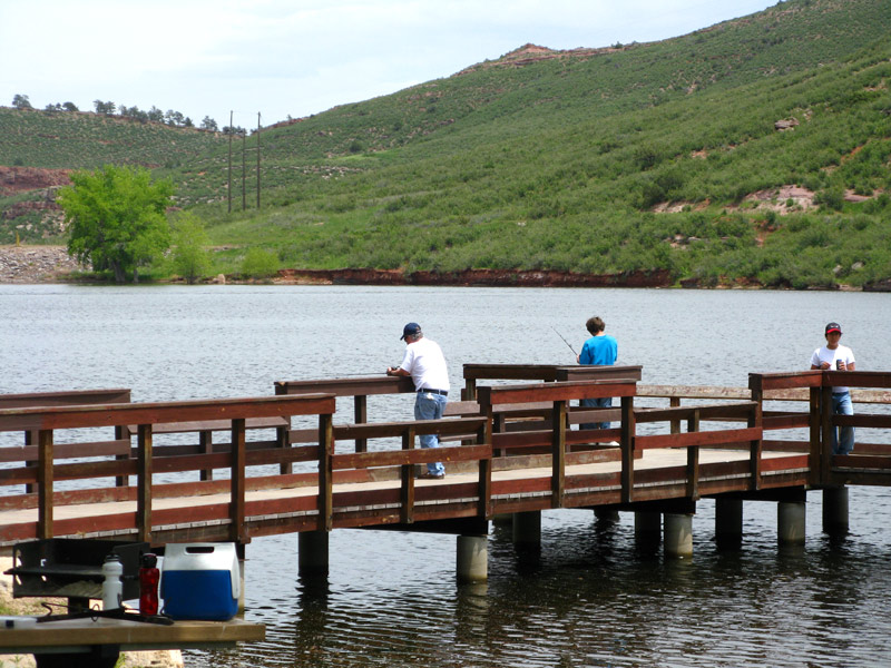
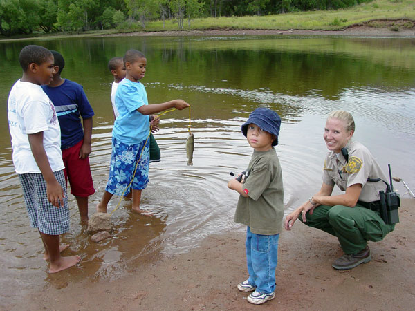
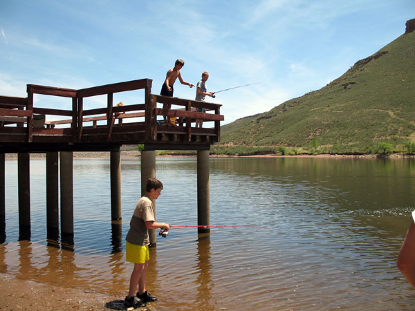
Fishing
- No ice fishing – ice is unsafe due to water fluctuations.
- Stocked with rainbow trout several times during the spring and fall months.
- Anglers have luck fishing from the shoreline with baits and spinners.
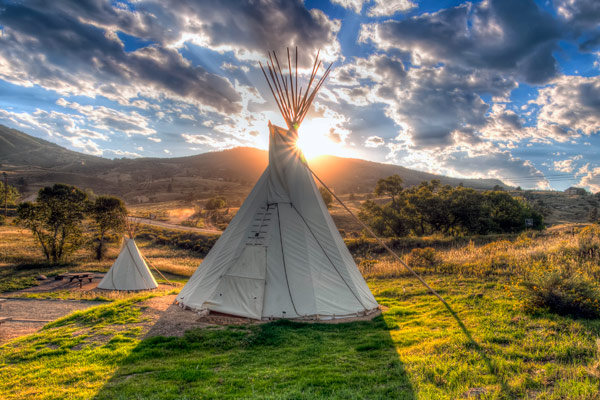
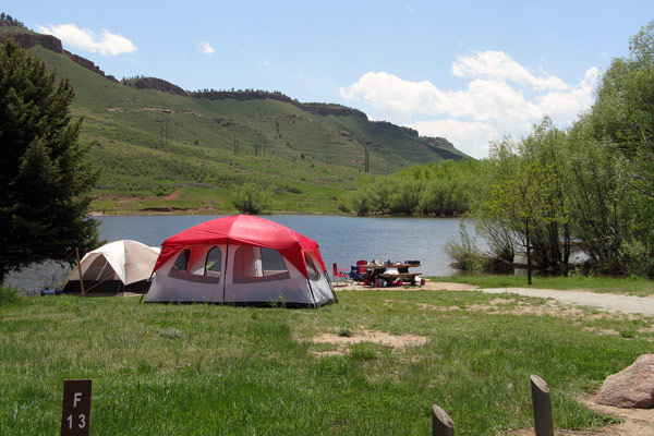
Camping
- Electrical and tent
- Campground host on duty during the summer.
- No Secondary Camping units allowed. Additional ground tents are okay.
- March 1 - October 31: Sites can be reserved from 180 days to 1 day in advance the arrival date at www.larimercamping.com or by calling the reservation call center at 1-800-397-7795. Sites that are not reserved in advance become available that day as first-come, first-served for people who are physically present at the parks. Same day reservations will be accepted at park visitor centers during regular business hours. These sites cannot be held over the phone, nor can their availability be guaranteed prior to arrival in-person.
- November 1 - February 28/29 same day reservations can be made online at Carter Lake, Flatiron Reservoir, and Pinewood Reservoir. Campers MUST make a reservation and purchase a park entrance permit BEFORE setting up at any campsite.
- November 1 - February 28/29 same day reservations at Horsetooth Reservoir and Hermit Park must still be done at the park. (Hermit Park closes for the season Dec 20 - March 1)
- A permit to camp is required for each campsite for each night (in addition to Park Entrance Permits).
- Maximum of 14 nights in any 30-day period.


Photos
Click a photo to enlarge.
Regulations
For specifics, ask a ranger or see a kiosk for a copy of the Regulations.
- No boating allowed.
- Swimming is prohibited.
- No access to the southeast side, or the dam, due to Homeland Security restrictions.
- Quiet hours are 10 p.m. to 6 a.m.
- Collection of firewood, including cutting of trees and branches, is not allowed.
- Firearms or fireworks are prohibited.
- Glass containers are not allowed.
- Drones are prohibited.
- Alcohol is only allowed in campsites. No alcohol in day use areas.
- Dogs must be on leashes not longer than 10 feet at all times.
