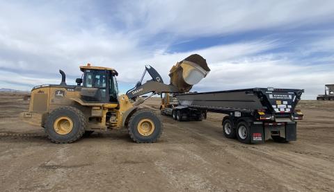
Larimer County is actively evaluating potential aggregate sources to support its long-term, geographically dispersed quarry strategy. By locating small aggregate quarries close to the non-paved that need to be maintained, the County aims to reduce haul distances, minimize widespread traffic impacts and green house gas emissions, and maintain safe, reliable access for residents, businesses, recreators, and emergency responders.
How Sites are Selected
Finding suitable aggregate sources is a highly selective process. Before any site-specific sampling occurs, potential sites are screened through a multi-step process to ensure they meet technical, environmental and community standards.
From an initial pool of sites, only a small fraction meet all criteria to advance to site-specific material testing.
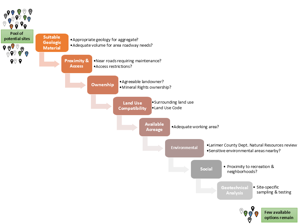
1. Geologic Suitability: Does the site have the appropriate geology suitable to develop into aggregate? Is there a sufficient likely volume of material to serve the non-paved roads in the vicinity?
2. Proximity & Access: Is the site close to non-paved roads requiring ongoing maintenance? Is access to the site clear and unrestricted?
3. Ownership & Partnership: Is there an agreeable landowner or a viable partnership opportunity with state or federal public land agencies (ex., US Forest Service of Colorado State Land Board)? Does the landowner own the mineral rights or is there also an agreeable mineral rights owner?
4. Land Use Compatibility: Is the site generally compatible with surrounding land uses and the Larimer County Land Use Code standards? Is there a history of mining in the area?
5. Available Acreage: Does the site provide an adequate workable footprint for a suitable quarry plan design and safe operations?
6. Environmental Sensitivity: Every site is reviewed by Larimer County's Department of Natural Resources for potential conservation value, viewshed potential from highly traveled County corridors, and nearby ecological resources. Sites are also evaluated for the presence of nearby sensitive ecosystems, water bodies, or wildlife habitats.
7. Social & Community Distance: Is the site distanced from dense residential neighborhoods and high-use recreation areas?
8. Geotechnical Analysis: Only sites passing all prior screening criteria will proceed to site-specific subsurface sampling and material characterization to determine if the material is suitable for roadway aggregate.
Environmental Impacts Analysis
Any site that successfully passes the screening steps above undergoes extensive, site-specific environmental analyses. The current or baseline environmental conditions are studied, as well as potential impacts related to the proposed project. Technical studies are performed to analyze the current (baseline) conditions as well as potential impacts to the following resources, at a minimum:
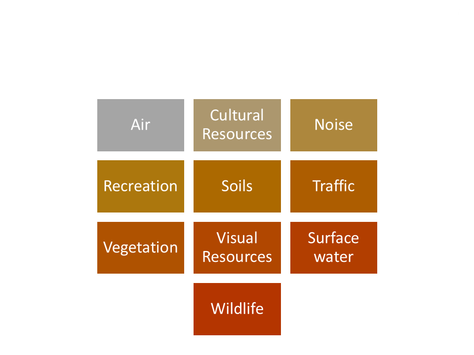
Information gained during these environmental impacts studies informs Larimer County's project design, including development of measures to avoid and minimize impacts to the resources that could be impacted by the project.
Permitting & Approval Process
Before any excavation can occur at a site, Larimer County must lead each site through a rigorous permitting process involving multiple federal, state and County agencies. The specific permitting processes required for a site depend on factors such as the size of the site and the property owner. Each process includes opportunities for public comment.
If a proposed site is located on federal land (such as US Forest Service property), the site must first undergo a rigorous National Environmental Policy Act (NEPA) environmental assessment and public review process prior to state and county permitting.
Regardless of the property owner, Larimer County must also navigate each site through the permitting steps shown below.
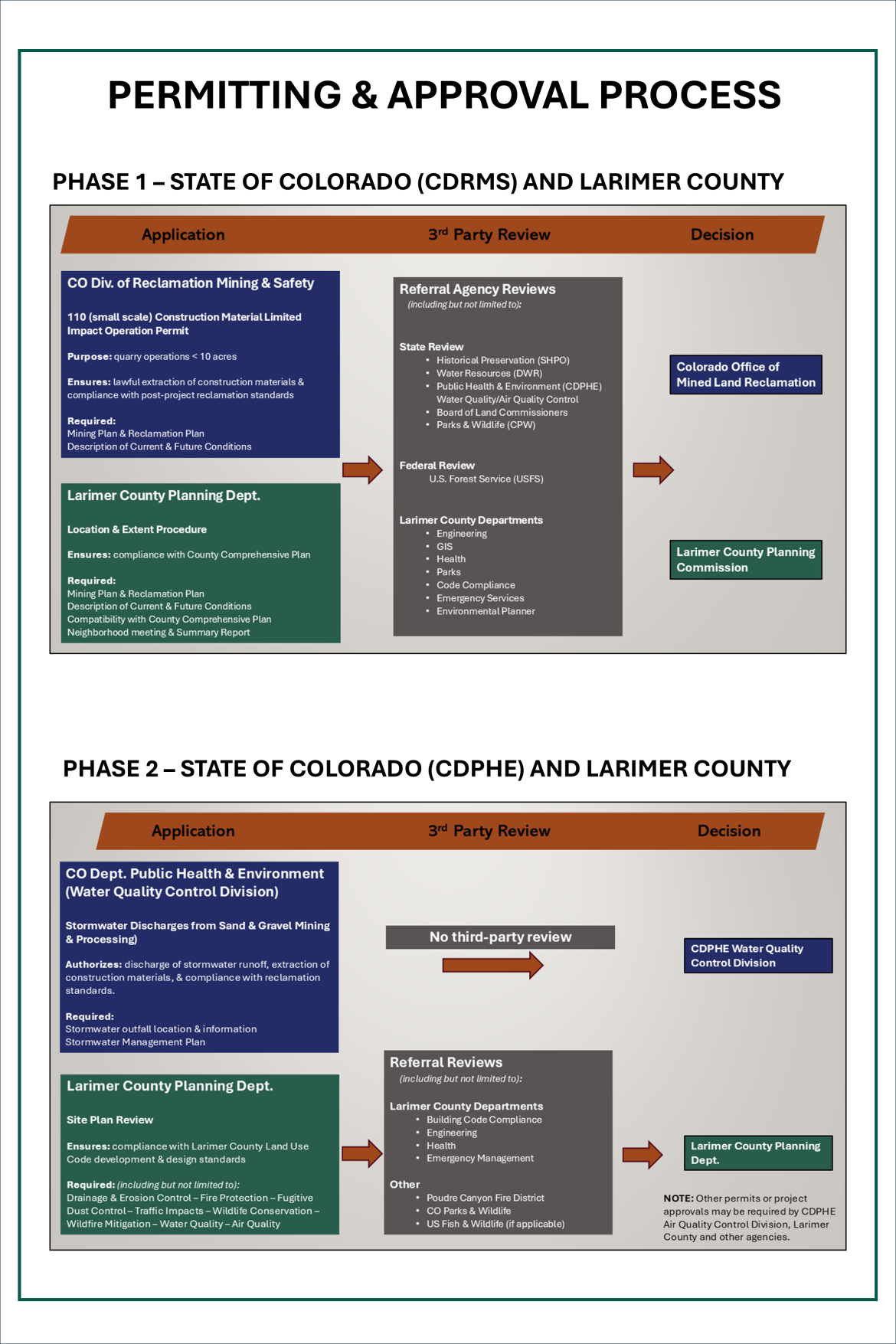
Note: if a site is located on federal land, a prior environmental assessment must be conducted through NEPA before any state or County permitting can occur.
Current Projects
Larimer County is currently pursuing expansion of a dormant quarry on Colorado State University property near the CSU Mountain Campus. Learn more about that project here:
Other projects are in various stages of screening and investigation and will be added to this page as more information is available.
Learn more about current gravel sources.
